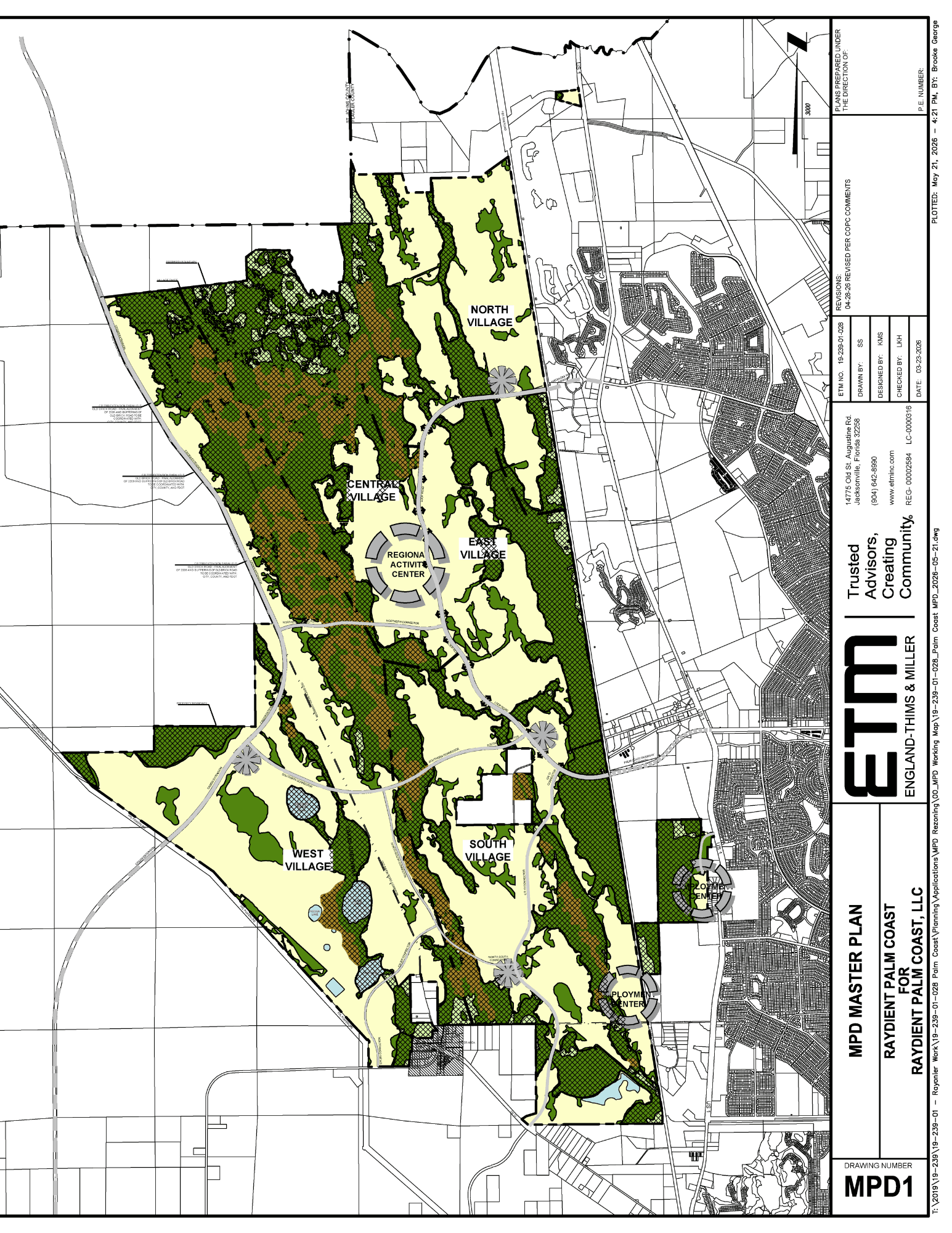
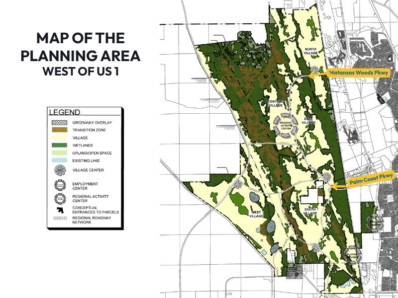
Future Planning Area West of U.S. 1
This project is no longer under consideration by the City. Should the applicant wish to pursue the proposal in the future, the requests would need to be resubmitted to the City for consideration through the applicable review and approval processes.
At-a-Glance Overview
Proposed Area
Approximately 20,144 acres | Located west of U.S. 1 | Long-term planning horizon of approximately 30 years
Proposed Components
Employment centers | Commercial and retail areas | Recreation opportunities | Residential neighborhoods | Greenway and conservation areas | Transportation improvements
Planning Framework
Imagine 2050 Comprehensive Plan | Master Planned Development (MPD) application | Future Public Facility Agreements
Understanding the Proposal
Development Occurs in Phases

How Individual Projects Are Reviewed
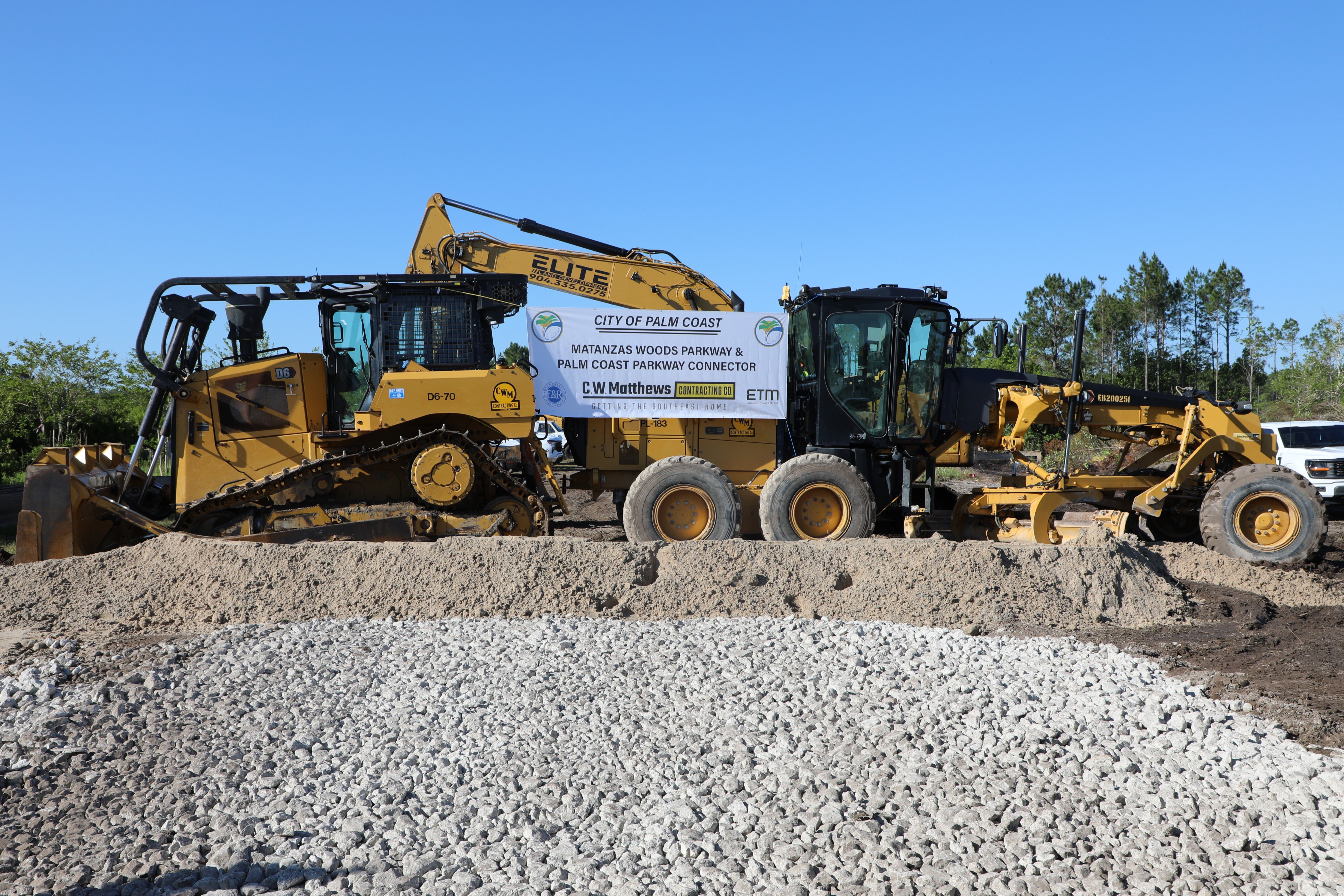
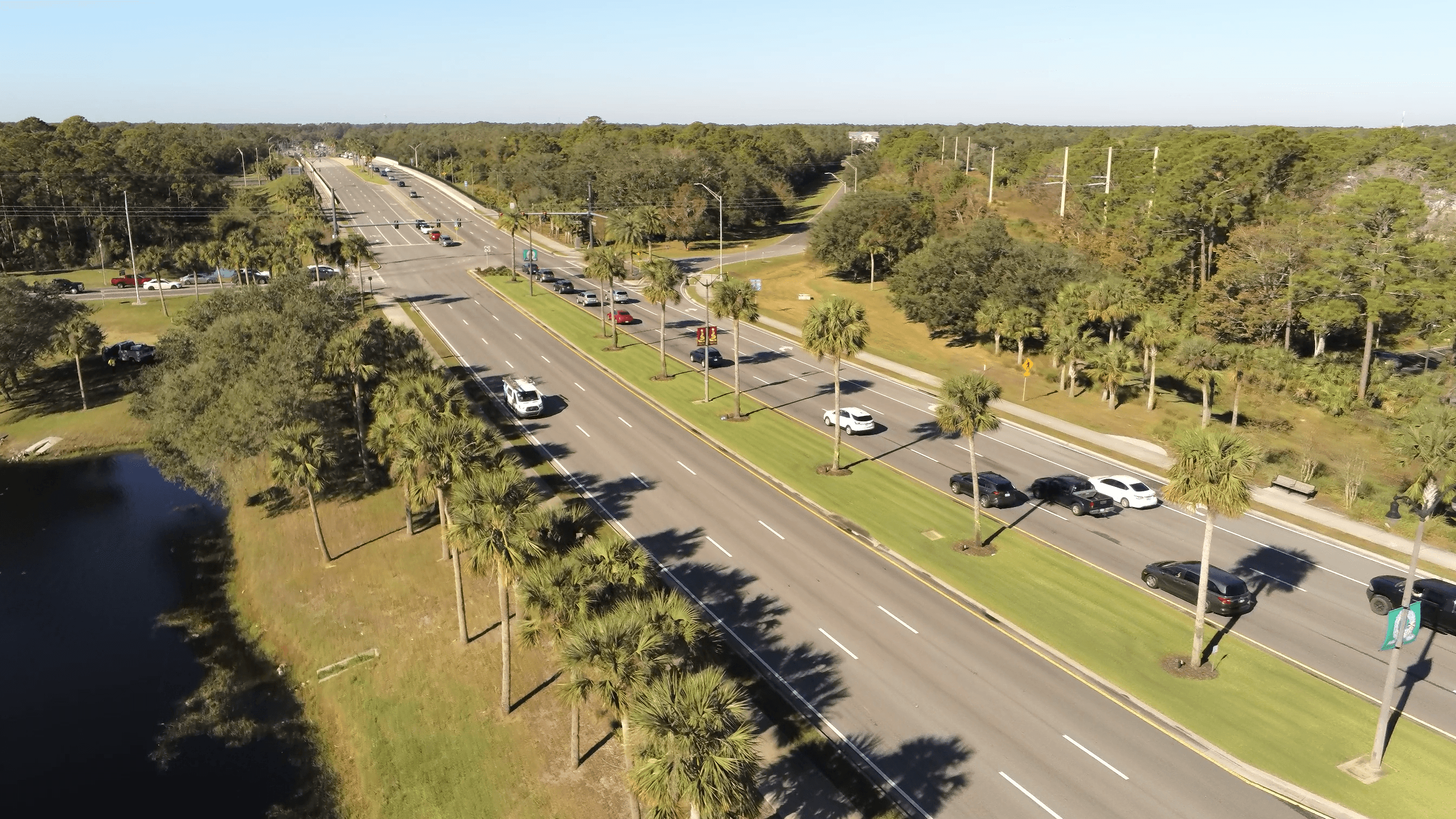
Matanzas Woods Parkway Loop Road
Proposed Land Uses
Greenway Overlay
Conservation, recreation, open space
Villages
Residential neighborhoods
Neighborhood Centers
Schools, parks, civic uses, neighborhood services
Village Centers
Retail and services
Regional Activity Center
Employment, shopping, healthcare, entertainment
Employment Center
Office, industrial, warehouse, and employment uses
Frequently Asked Questions
The proposed Master Planned Development (MPD) is a zoning and development framework for approximately 20,144 acres located west of U.S. 1. The proposal includes a mix of potential land uses, including residential neighborhoods, employment areas, commercial development, recreation opportunities, open space, and transportation infrastructure.
The MPD establishes the overall development framework for the area. Specific development proposals, infrastructure agreements, and permitting requirements would be addressed through additional review processes if the MPD is approved.
The lands west of U.S. 1 were identified during the City's Imagine 2050 Comprehensive Plan process as an area for future planning and potential development. The Comprehensive Plan established future land use policies for the area and created a Master Planned Mixed Use land use designation intended to guide long-term planning.
The proposed MPD is intended to implement those adopted land use policies by establishing development standards, land use categories, transportation connections, open space areas, and other planning elements for the property.
Raydient, the landowner of the majority of the lands west of US 1, has submitted the application that is currently under review through the City's public development review process.
The proposed MPD encompasses a larger geographic area than the previously approved Old Brick Township and Neoga Lakes DRIs and includes land that was not part of those developments.
According to the applicant, the MPD would replace the existing DRI entitlements and establish a new planning framework for the area. The proposal includes updated land use patterns, transportation connections, open space areas, and development standards that differ from those contained in the previous DRI approvals.
The proposed MPD also includes transportation corridors associated with future regional transportation planning efforts, including the proposed County Road 2209 corridor.
The proposed MPD covers approximately 20,144 acres, which is a larger area than the previously approved Old Brick Township and Neoga Lakes DRIs. Because the proposal includes additional land, it also includes additional residential, commercial, employment, recreational, and open space areas.
According to the applicant, the overall development intensity is intended to be similar across the expanded planning area, resulting in a greater number and variety of proposed land uses.
The proposed MPD includes additional areas designated for commercial, office, healthcare, industrial, recreational, and residential uses compared to the previous DRI approvals.
The proposal also includes a planned Employment Center adjacent to the rail corridor that is intended for industrial and employment-generating uses. The specific mix, timing, and scale of future development would be determined over time through additional planning, infrastructure agreements, and development review processes.
Future development within the MPD would be subject to applicable state and federal environmental and permitting requirements. According to the application, studies related to historic and cultural resources, as well as threatened and endangered species, would be completed as required during future permitting processes.
The proposal identifies approximately 8,501 acres as a Greenway Overlay and indicates that approximately half of the overall property is planned for open space and recreation-related uses. Proposed uses within these areas may include conservation lands, wetlands, trails, parks, stormwater facilities, utilities, and certain agricultural and recreation activities, subject to applicable approvals.
The proposal also includes development patterns that transition from more urban and suburban areas to lower-intensity uses closer to conservation areas and wildlife corridors. Environmental impacts and permitting requirements would be evaluated through applicable state and federal review processes.
Old Brick Road is a historic roadway that passes through portions of the planning area. Coordination is ongoing with the City of Palm Coast, Flagler County Government, and the applicant regarding future planning efforts, including consideration of regional transportation projects and preservation of historical resources.
Specific decisions regarding Old Brick Road have not yet been finalized.
The proposed MPD is scheduled for review by the Planning and Land Development Regulation Board, which will make a recommendation to the City Council. The proposal would then be considered by the City Council through two public hearings.
If approved, additional Public Facilities Agreements addressing topics such as transportation, utilities, schools, public safety, and other infrastructure requirements would be developed and considered separately.
Approval of the MPD would establish the overall planning framework for the area. Future development would remain subject to applicable site plan reviews, engineering reviews, permitting requirements, and infrastructure agreements before construction could occur.
If approved, there are several steps before construction can begin:
- Public Facilities Agreements are developed.
- Individual projects are submitted for Substantial Completion review.
- Technical Site Plans are reviewed.
- Infrastructure is constructed (utilities, roads, schools, parks, and fire protection).
- Building permits may then be issued.
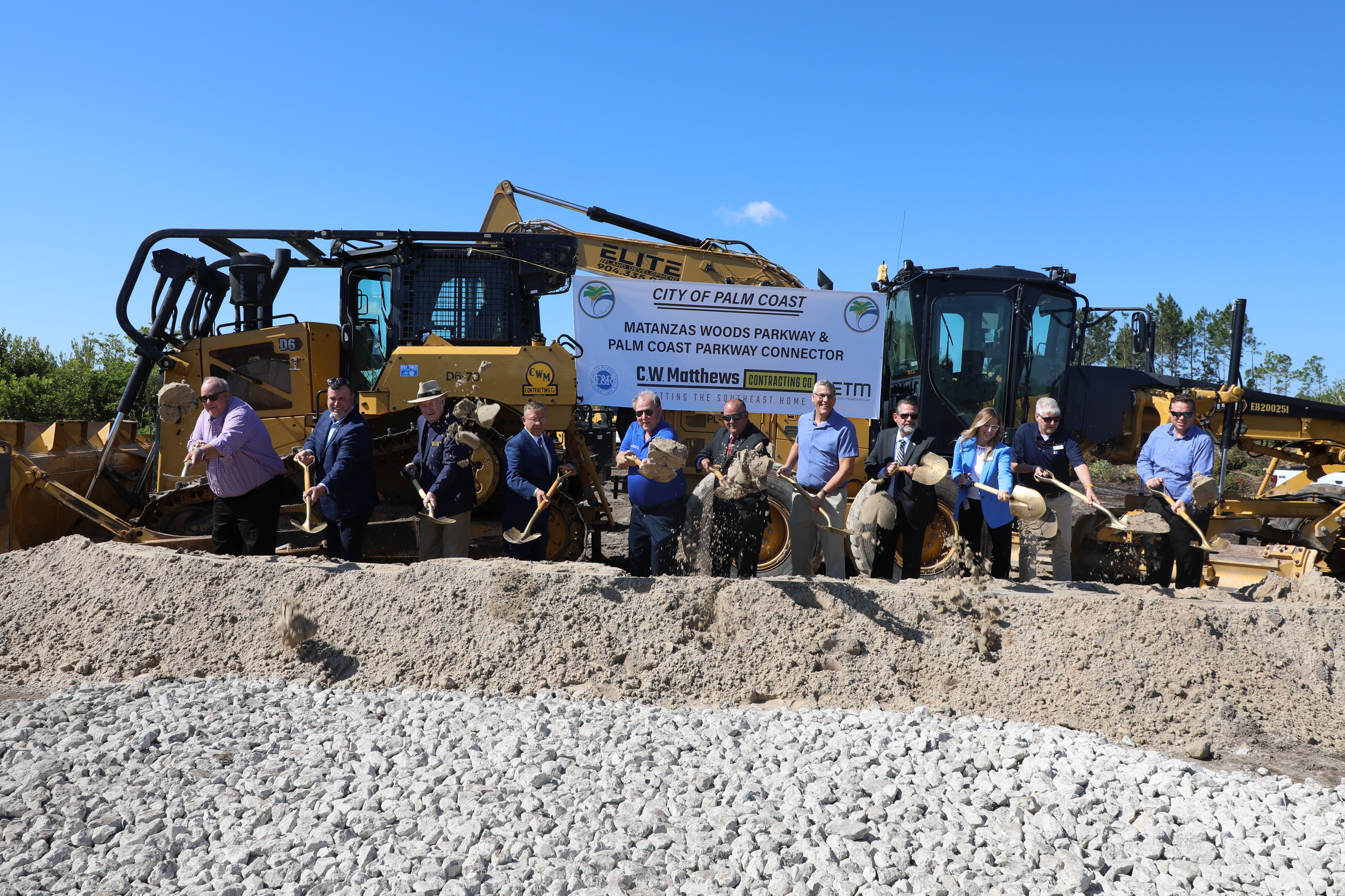
The Matanzas Loop Road project is a transportation improvement currently under construction west of U.S. 1. The project includes a new roadway corridor and a bridge (or flyover) crossing over the Florida East Coast Railway.
The roadway is intended to improve connectivity, support future transportation needs, and provide additional transportation options within the region. The project is funded through state appropriations from the Florida Department of Transportation.
Any future development within the MPD would require utility planning and infrastructure analysis to determine water and wastewater service needs.
Utility agreements would be developed to address infrastructure requirements associated with future development. The City and applicant have planning efforts underway to evaluate future utility needs and potential infrastructure improvements.
The MPD application includes a concept for a regional sports and recreation facility within the planning area. The proposal identifies land that could potentially accommodate athletic fields, recreational facilities, and related uses.
No final decisions have been made regarding the design, funding, construction, ownership, or operation of any future sports facility. Additional evaluation and approvals would be required before such a project could move forward.
The proposed MPD identifies approximately 180 acres for recreation-related uses. By comparison, the previously approved Neoga Lakes DRI included a smaller recreation area.
The proposal also includes greenway and open space areas that would be interconnected throughout portions of the planning area. Specific recreational amenities and facilities have not yet been determined.
If approved and developed over time, the MPD would introduce a mix of residential, commercial, employment, recreational, and open space uses within the planning area west of U.S. 1.
The proposal includes an Employment Center, Regional Activity Center, Village Centers, transportation infrastructure, and conservation areas. The timing, scale, and sequence of development would occur over many years and would be subject to future infrastructure planning and regulatory review.
A 2024 draft economic impact study prepared for the project estimates that full buildout of the planning area over approximately 30 years could result in additional jobs, property value, economic activity, and public revenues. It indicated approximately 13,375 new jobs, $6 billion in property value, and $14 billion in total economic output over 30 years. The net benefit after services is estimated to be approximately $2.5 billion in impact fees and tax revenue over time.
The study is currently being updated, and its findings will be considered alongside other information during the review process. Economic projections are estimates based on assumptions about future market conditions and development patterns.
Potential names for future districts, roadways, neighborhoods, and activity centers have not yet been determined.
"Westward Expansion" is the term used during the City's Imagine 2050 Comprehensive Plan process to identify the area generally located west of U.S. 1. Future naming decisions may occur as planning and development activities progress.
Full buildout could occur over several decades, although the timing would depend on market conditions, infrastructure availability, regulatory approvals, and other factors. Specific development phases and schedules have not been finalized. The proposed Development Agreement outlines three phases of development, with an anticipated buildout extending through 2056.
Downloadable Materials
-
Palm Coast Pre-Application Meeting.03.09.2026-Westward Expansion
Palm Coast Pre-Application Meeting.03.09.2026-Westward Expansion
Download1.59 MB
-
Westward Expansion MPD Development Summary Map
Westward Expansion MPD Development Summary Map
Download1.72 MB